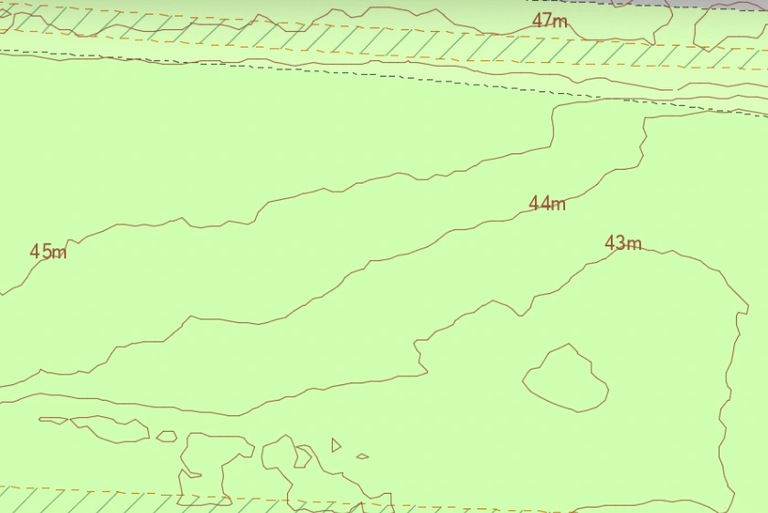
A step by step guide to help purchase your contours map through our website.
14 Jan 2022
Find out why planning maps provided by the Ordnance Survey are the best and how you can order them quickly.
13 Jan 2022
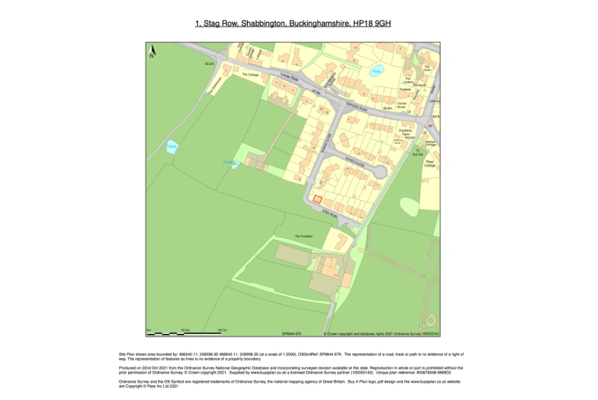
Find out what should be included in a location plan, how to get one and what it can be used for.
13 Jan 2022
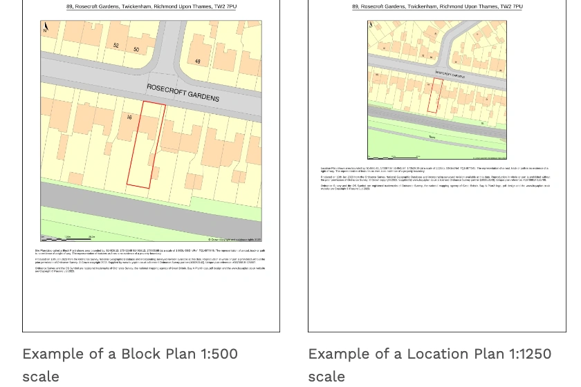
A comprehensive guide explaining site and location plans.
13 Jan 2022
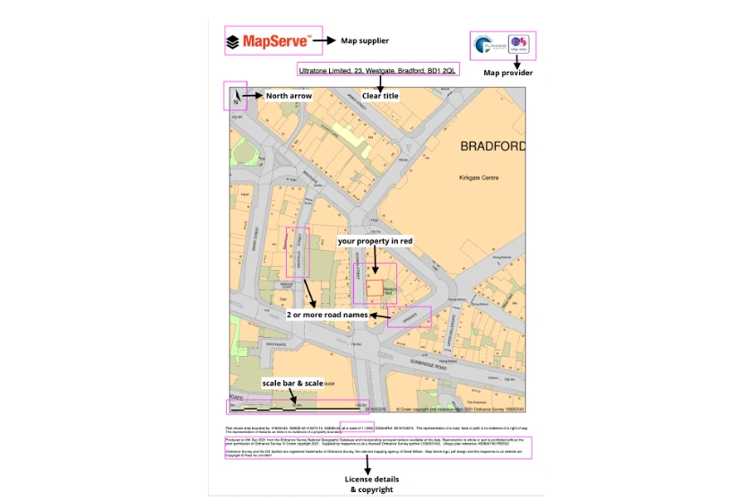
An extensive guide to help you create your location plan.
13 Jan 2022
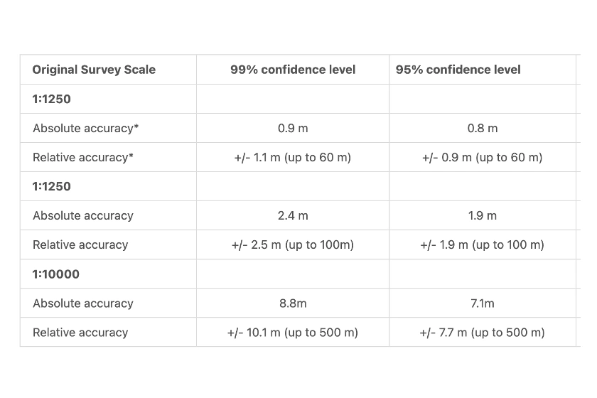
Read all about OS MasterMap®'s accuracy, continuous surveying and features.
13 Jan 2022
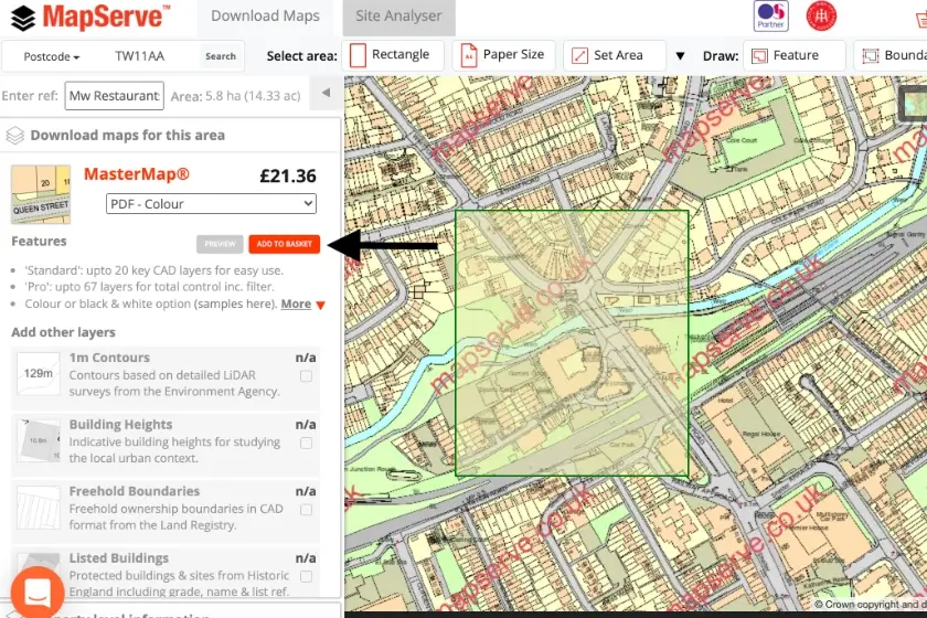
A comprehensive guide on how to create your location plan on MapServe® using OS MasterMap® and our powerful tools.
13 Jan 2022
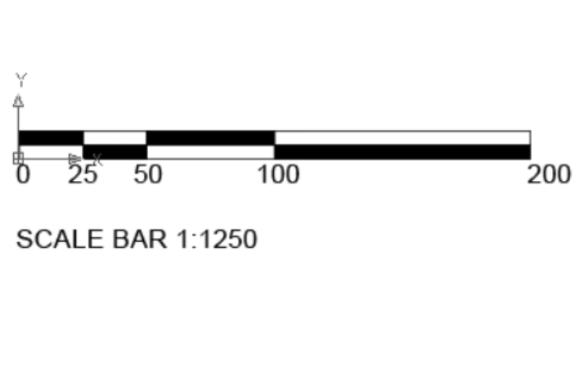
A quick guide of OS MasterMap® stating its use, scale and what it includes
13 Jan 2022
Find out why OS MasterMap® is the most important product of the Ordnance Survey and download it now for your future and current projects.
13 Jan 2022