
Using 1m contour data on MapServe® reveals five critical site risks: drainage, access gradients, excavation surprises, flood vulnerability & SuDS conflicts, helping UK professionals save time, money & compliance hassle.
16 Jun 2025
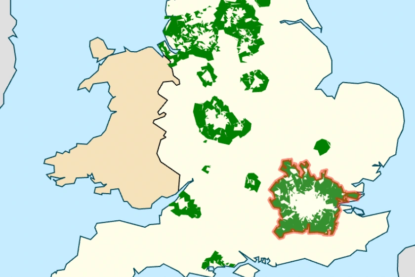
This article examines Metropolitan Green Belt reform, Grey Belt classification, housing delivery data and the role of mapping tools in planning.
23 May 2025

Upgrading your mapping provider can save hours of work, reduce stress, and streamline project workflows in the built environment sector.
23 Apr 2025


Geospatial data is transforming construction and development in the UK by enabling smarter, more sustainable and digitally integrated project delivery.
26 Mar 2025

This guide explores common digital mapping issues in the UK construction industry and provides practical solutions to improve accuracy, security and efficiency.
19 Mar 2025

Get clear answers to the most common questions about OS MasterMap®, covering costs, accuracy, updates, and how to access data through MapServe®.
12 Mar 2025

Mapping technologies can help address the UK construction skills gap by enhancing training, workforce planning and project efficiency.
05 Mar 2025

This article explores essential mapping solutions, 3D visualisation techniques and geospatial data best practices for structural engineers in the UK.
26 Feb 2025