In the rapidly evolving landscape of structural engineering, mapping solutions have emerged as indispensable tools. These technologies enable precise design, efficient execution, and improved safety of engineering projects. The UK’s engineering sector, known for its stringent regulations and cutting-edge innovations, has embraced these solutions to address complex infrastructure challenges. This article explores best practices for mapping in structural engineering, focusing on 3D visualisation, geospatial data and recent developments in the UK.
Access professional maps for structural engineers
The Role of Mapping Solutions in Structural Engineering
Mapping solutions provide structural engineers with detailed spatial data that forms the backbone of accurate analysis and design. With the advancement of Geographic Information Systems (GIS) and 3D visualisation tools, traditional engineering methods have been revolutionised. Engineers can now comprehensively model structures within their environmental contexts, improving the decision-making process.
Accurate geospatial data is critical, particularly in urban areas like London, where underground utilities, heritage buildings, and densely packed infrastructure present significant challenges. Mapping solutions offer a holistic view of these elements, enabling better planning and risk assessment. Services such as those provided by MapServe® offer essential mapping products, including detailed topographical and planning application maps. These resources help engineers gain precise insights during the planning and design phases, enhancing the accuracy of site assessments and facilitating smoother project workflows.

Best Practices for Mapping Solutions in Structural Engineering
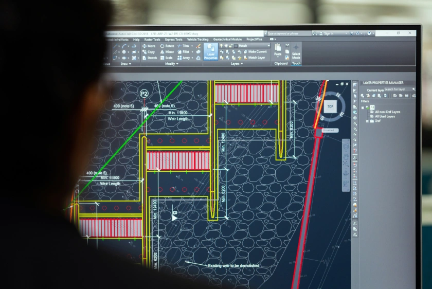
1. Integrating 3D Geospatial Data
3D geospatial data allows engineers to visualise and analyse structures in three-dimensional space. This facilitates a better understanding of complex designs and their interactions with surrounding environments. Tools such as ArcGIS provide integrated 3D systems, enabling smart environments and digital twins. Digital twins are virtual models that replicate physical structures, providing real-time data to inform decisions throughout the asset’s lifecycle.
Additionally, MapServe.co.uk offers mapping solutions that support 3D visualisation requirements. Their detailed maps integrate seamlessly with 3D modelling software, aiding engineers in creating accurate digital representations for complex projects.
3D visualisation is particularly beneficial in urban construction projects, where spatial constraints demand precision. For example, the Thames Tideway Tunnel project in London relied heavily on 3D geospatial data to navigate underground utilities and minimise disruptions to existing infrastructure.
2. Adopting Building Information Modelling (BIM)
Building Information Modelling (BIM) is a digital representation of a facility's physical and functional characteristics. Since 2016, the UK government has mandated the use of collaborative 3D BIM on public projects, recognising its potential to enhance efficiency and reduce costs. BIM enables stakeholders to access a shared knowledge resource, supporting decisions throughout the project's lifecycle.
Data sourced from MapServe.co.uk can complement BIM processes by providing high-quality, ready-to-use mapping data that integrates directly into BIM platforms. This streamlines project planning, reduces delays, and ensures that designs are based on reliable spatial information.
The Crossrail project (Elizabeth Line) is a prime example of BIM’s impact. The project utilised BIM to manage complex design processes, coordinate among multiple contractors, and ensure adherence to timelines and budgets. The integration of BIM with geospatial data provided a comprehensive understanding of site conditions, leading to more informed design and construction decisions.
3. Leveraging Advanced Visualisation Tools
Advanced visualisation tools enable engineers to communicate complex data effectively. The British Geological Survey (BGS) has developed 3D visualisation systems that assist in understanding varied datasets, enhancing decision-making in structural projects. These systems allow for interactive exploration of geological data, providing insights into subsurface conditions that impact structural design.
Visualisation tools are also critical in stakeholder engagement. Products from MapServe.co.uk provide accessible map formats that can be shared easily among project teams and stakeholders. By presenting complex engineering concepts in an accessible format, engineers can facilitate discussions with non-technical stakeholders, ensuring that projects meet community needs and regulatory requirements.
4. Ensuring Data Accuracy and Integrity
Accurate data is the cornerstone of effective mapping solutions. Engineers must ensure that geospatial data is precise and up-to-date. Collaborating with reputable geospatial service providers, such as AECOM and MapServe.co.uk, which utilise the latest technologies to capture and analyse spatial information, can enhance data reliability.
MapServe.co.uk offers Ordnance Survey maps, planning maps, and historical maps that provide engineers with essential, accurate data. Their data validation processes ensure that users access the most current information, reducing the risk of errors and rework.
Quality assurance processes, including data validation and verification, should be integral to engineering workflows. Regular audits and updates of geospatial datasets ensure that engineers work with the most current information, reducing the risk of errors and rework.
5. Incorporating Geospatial Data in Risk Management
Geospatial data plays a vital role in risk management by providing insights into environmental and structural risks. Engineers can analyse data on flood zones, seismic activity, and soil conditions to identify potential hazards and develop mitigation strategies. For instance, the High Speed 2 (HS2) project incorporates extensive geospatial data analysis to assess geological risks along the proposed route.
Data provided by MapServe.co.uk can support risk management by offering access to flood risk maps, elevation data, and other environmental datasets that inform early-stage project decisions.
Risk management is further enhanced by integrating geospatial data with predictive analytics. Machine learning algorithms can process large datasets to predict potential risks, enabling proactive decision-making and improving project resilience.
6. Continuous Professional Development
The field of geospatial technologies is continually advancing. Structural engineers must engage in ongoing education and training to stay abreast of the latest tools and methodologies. Professional organisations, such as the Institution of Structural Engineers (IStructE), offer resources and guidance to help engineers maintain and enhance their competencies.
Participation in industry conferences, workshops, and certification programmes ensures that engineers are equipped with the skills needed to leverage emerging technologies. Moreover, collaboration with academic institutions and research organisations fosters innovation and drives the adoption of best practices.
Case Study: Grenfell Tower Demolition
A notable example of mapping solutions in action is the planned demolition of Grenfell Tower in London. The building’s sensitive history and location above two London Underground lines necessitate a highly controlled demolition process. Traditional methods are unsuitable due to the risk of damage to surrounding infrastructure and the emotional impact on the local community.
Engineers have proposed a "top-down" demolition approach using small, remote-controlled excavators. These robotic devices will be lowered onto the roof to deconstruct the building piece by piece, ensuring safety and precision. Advanced mapping and structural analysis are crucial in planning and executing this complex project, providing insights into load distribution and structural integrity.
The Grenfell Tower project highlights the importance of integrating mapping solutions with ethical considerations. Engineers must balance technical requirements with community concerns, demonstrating sensitivity to the building's history while ensuring public safety.

Recent Developments in the UK
The UK continues to invest in digital infrastructure and geospatial technologies to support engineering and construction sectors. The Geospatial Commission, established in 2018, plays a pivotal role in unlocking the economic potential of geospatial data. Its initiatives aim to improve data accessibility, promote innovation, and enhance public services.
One significant development is the UK’s National Underground Asset Register (NUAR), a digital map of underground pipes and cables. NUAR aims to reduce accidental damage during excavation, improve safety, and streamline infrastructure projects. For structural engineers, access to reliable underground data is essential for accurate site assessments and risk management.
MapServe.co.uk complements these national initiatives by providing accessible, accurate mapping products that assist engineers in understanding underground assets. Their services help reduce excavation risks and ensure compliance with safety standards.
Moreover, the UK government’s emphasis on sustainable construction practices has driven the adoption of geospatial technologies in environmental impact assessments. Engineers can analyse geospatial data to design structures that minimise ecological disruption, aligning with sustainability goals.
The integration of advanced mapping solutions, including 3D visualisation and geospatial data, is transforming the field of structural engineering. Best practices—such as adopting BIM, leveraging advanced visualisation tools, ensuring data accuracy, incorporating geospatial data in risk management, and committing to continuous professional development—enhance project efficiency, safety, and sustainability.
By incorporating reliable mapping products from providers like MapServe.co.uk, engineers can further optimise their workflows, improve data accuracy, and support robust project outcomes. The Grenfell Tower demolition project exemplifies the critical role these technologies play in addressing complex engineering challenges in the UK. As geospatial technologies continue to evolve, their adoption will be key to driving innovation and maintaining the UK’s position at the forefront of structural engineering.