Download the latest Ordnance Survey Maps
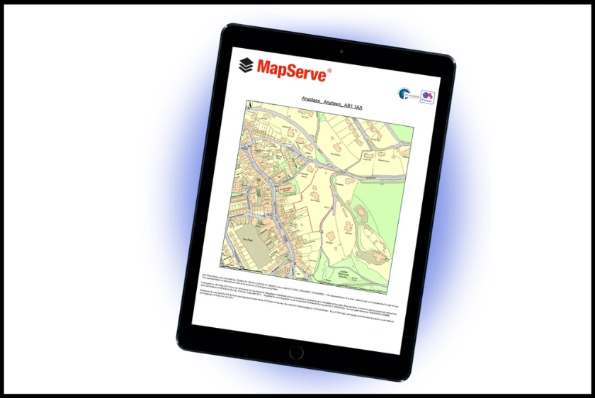
1. MapServe®
Comprehensive Access and User-Friendly Interface
MapServe® is at the forefront when it comes to accessing OS digital maps. This platform provides a seamless user experience with its straightforward registration process. Once you create an account, you gain access to an array of the latest OS digital maps, including the highly detailed OS MasterMap®. MapServe® offers advanced search capabilities, allowing users to find specific locations and features easily. The website also provides tools for measuring distances, annotating maps, and exporting data for further analysis, making it an excellent choice for professionals in architecture, planning, surveying, and all professionals.
Types of Maps Available
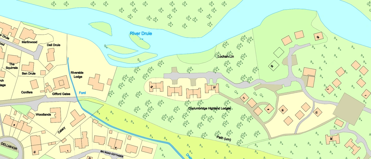
- OS MasterMap®: The most detailed and up-to-date map of the UK, perfect for professional users such as architects, engineers or surveyors. Available in many formats including CAD, PDF, PNG and GML.
- Topographic Maps: Ideal for outdoor activities, navigation and architectural plans.
- OS Road Map: Highlights transport routes including roads, rail and airports.
- OS Overview Map: Useful for larger areas containing an array of information including roads, railways, vegetation, natural boundaries, urban extents and more.
- Thematic Maps: Detailed maps for specific purposes such as land use and transportation.
- Historical Maps: Ideal for Design & Access Statements, Heritage Statements and much more.

2. Ordnance Survey (OS) Website
Direct from the Source
The Ordnance Survey's official website is another primary source for obtaining digital maps. As the national mapping agency for Great Britain, OS provides a comprehensive range of digital maps directly to users. Their platform offers various subscription options, catering to both individual needs and professional requirements.
Types of Maps Available
- OS Maps: Interactive maps for personal and professional use.
- OS OpenData: Free geographic data for non-commercial use.
- Customisable Maps: Tailor maps to your specific needs with various layers and data points.

3. Digimap
Educational and Research Focus
Digimap is an online service that provides access to a variety of maps and mapping data, including OS maps. It is particularly geared towards the academic and research community, offering a range of resources that support educational projects and research initiatives. Subscriptions are often available through academic institutions, making it an excellent resource for students and researchers.
Types of Maps Available
- OS MasterMap®: Detailed maps for in-depth analysis.
- Historical Maps: Access to maps from different time periods for research.
- Land-Use Maps: Useful for environmental and urban studies.

4. Streetmap
Easy Access for Everyday Use
Streetmap is a user-friendly platform that offers easy access to OS digital maps for everyday navigation and exploration. It provides detailed street maps and can be used for planning routes, finding addresses, and exploring local areas. While it is not as feature-rich as professional platforms, it is ideal for casual users who need reliable and straightforward mapping tools.
Types of Maps Available
- Street Maps: Detailed maps for navigation and local exploration.
- Topographic Maps: Useful for outdoor activities such as hiking and cycling.

5. Avenza Maps
Mobile Access on the Go
Avenza Maps is a mobile application that provides access to a wide range of digital maps, including OS maps. This platform is particularly useful for outdoor enthusiasts and professionals who need reliable maps on their mobile devices. Avenza Maps offers offline access, ensuring that users can navigate and access information even without an internet connection.
Types of Maps Available
- OS Topographic Maps: Ideal for hiking, biking, and other outdoor activities.
- Custom Maps: Import and use your own maps alongside OS maps.

Advantages of Digital Maps vs. Paper Maps
Accuracy and Detail
Digital maps offer a level of detail and accuracy that is difficult to achieve with traditional paper maps. With continuous updates and real-time data, digital maps provide the most current geographic information available.
Convenience and Accessibility
Digital maps can be accessed from various devices, including computers, tablets, and smartphones, making them incredibly convenient. They are easily searchable, and users can zoom in and out to explore different levels of detail.
Versatility
Digital maps can be customized with various layers, data points, and annotations, making them versatile tools for different applications. Whether you need a detailed topographic map for hiking or a thematic map for urban planning, digital maps can be tailored to meet your needs.
Sustainability
Using digital maps reduces the need for paper, contributing to environmental sustainability. They can be stored and shared electronically, eliminating the need for physical storage and distribution.
In conclusion, obtaining OS digital maps is a straightforward process with numerous platforms offering high-quality options. Whether you choose MapServe®, the Ordnance Survey website, Digimap, Streetmap, or Avenza Maps, you can access a wide range of detailed and accurate maps tailored to your specific needs. The advantages of digital maps over paper maps are clear, making them an essential tool in today's digital world.