Introduction
Atelier Two is an architectural firm established in 2016 and is headquartered not far from Wilmslow, Cheshire. Past and present projects include architecture, conservation, interior design, and masterplanning. Ceri Turner studied at Newcastle University's School of Architecture, Planning, and Landscaping before joining Buckinghamshire firm Garrett McKee. He was appointed Associate Director in early 2017 after specialising in conservation and high-end residential projects across the country. He opened Atelier Two after relocating to the North West.
Ceri has been a MapServe® customer since 2019 and after trying our new 3D MasterMap® he managed to save a lot of precious time on his latest residential project as well as more than £1500 on surveyor fees. Here's how he got one...
Download your 3D MasterMap® here
Ceri Turner, Director at Atelier Two
Project Description
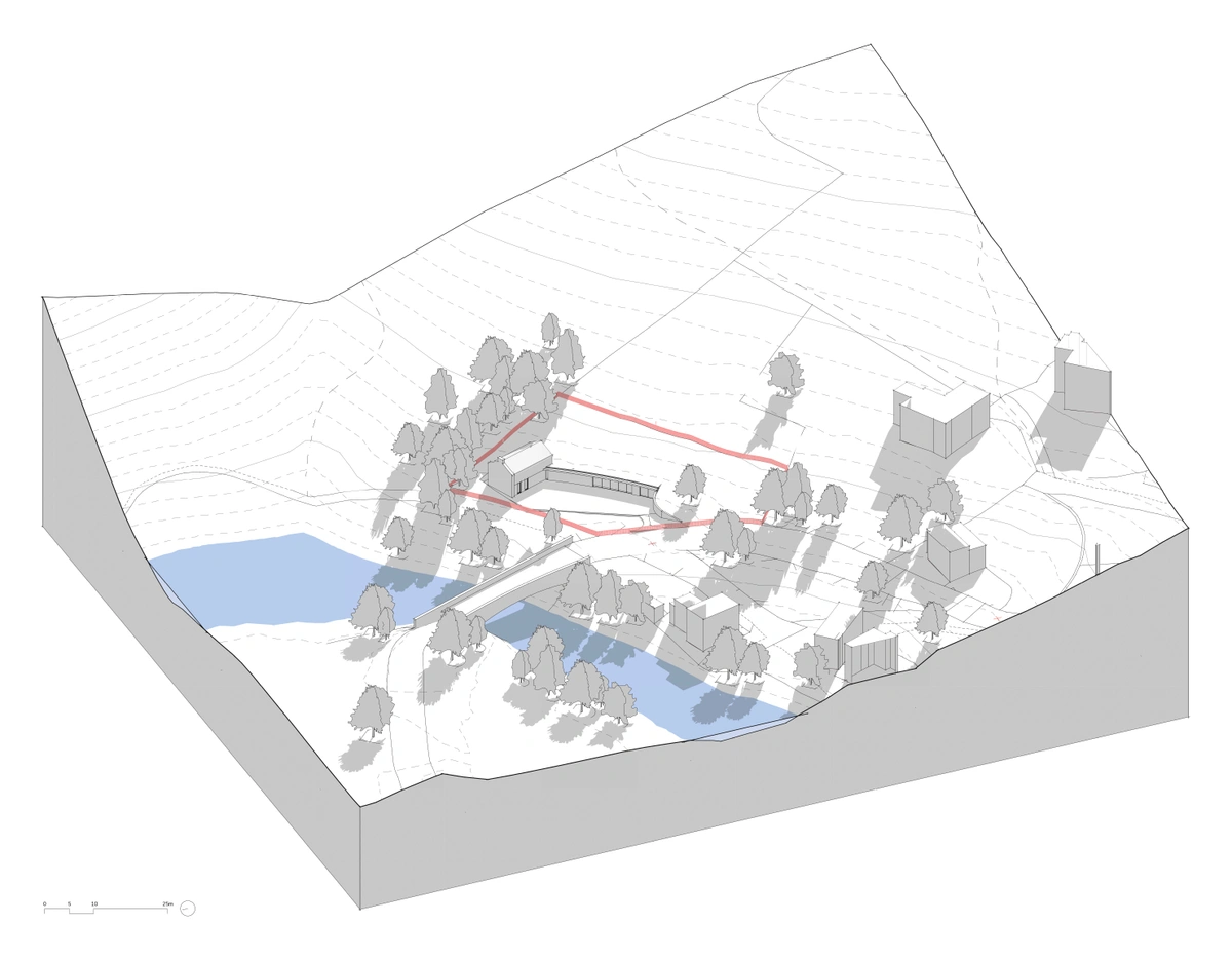
''Atelier Two was approached by a client looking to design a new residential dwelling within a South Cheshire Conservation Area. This project is currently in the initial feasibility stages, but considering the constrained nature of the plot, we always look to spend significant time at the beginning of the proposal assessing the strengths and opportunities of the site within the wider context. The attached 3D model shows an initial still from a solar study, looking at how the shelter and slope of the site can inform the location of the proposed dwelling.''
Benefits
How did 3D MasterMap® help Save Time and Money?
3D Model Image
3D Model provided by Atelier Two
The Impact of 3D Mapping in Architectural Projects
The integration of 3D mapping technology, such as the 3D MasterMap®, has revolutionised the way architects and planners approach site assessments and project feasibility studies. By providing highly detailed and accurate representations of the terrain, 3D maps facilitate a more in-depth understanding of the site’s characteristics, enabling better-informed decision-making and design processes.
Streamlining Project Timelines
The use of 3D MasterMap® significantly reduces the time required for initial site appraisals. Architects can quickly access detailed topographical data without the delays associated with traditional survey methods. This not only accelerates project timelines but also allows for more efficient allocation of resources and personnel.
Cost-Effective Solutions for Clients
For architectural firms, the adoption of 3D MasterMap® offers substantial cost savings. By eliminating the need for costly on-site surveys and reducing the time spent on manual data collection, firms can deliver high-quality services at a lower cost to their clients. This financial efficiency is particularly beneficial in the early stages of project development, where budgets are often tight.
Future Prospects
As 3D mapping technology continues to advance, its applications in architecture and urban planning are expected to expand. Future enhancements may include even more detailed models, integration with other geographic information systems, and real-time data updates, further improving the precision and utility of these tools.


