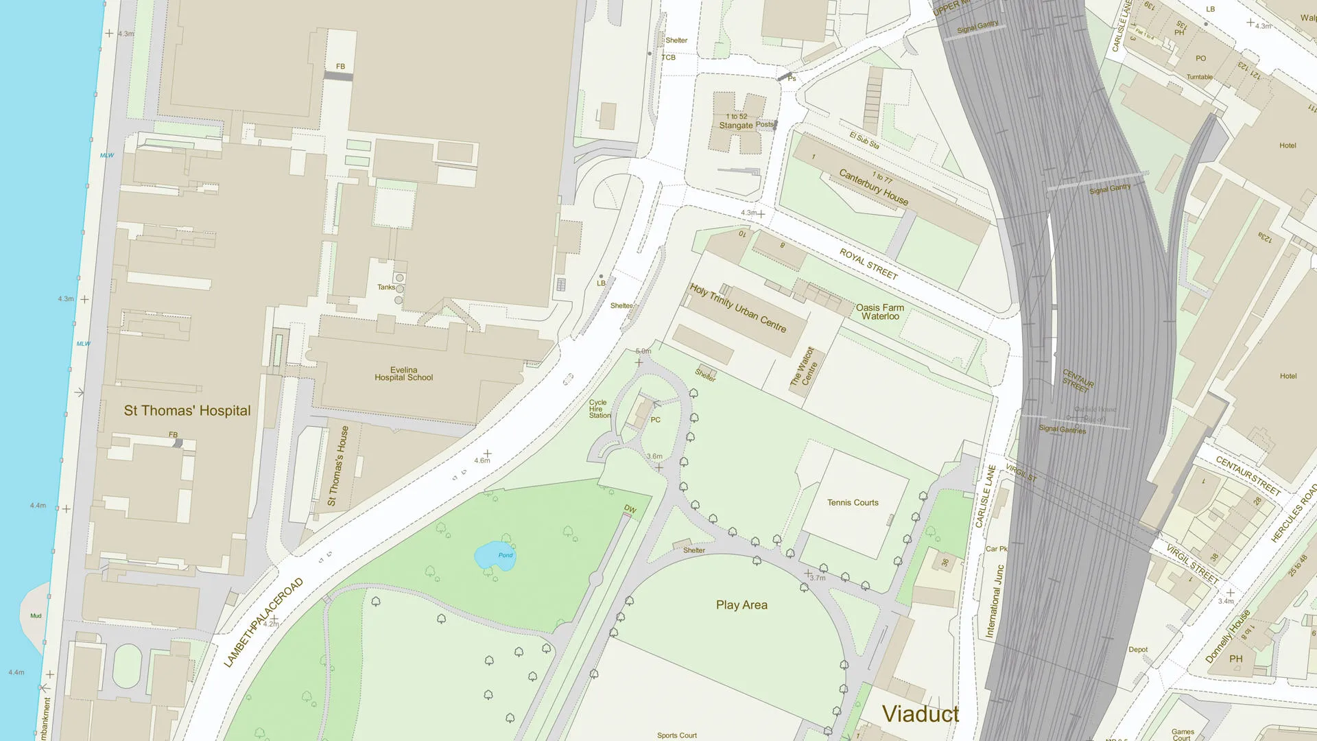
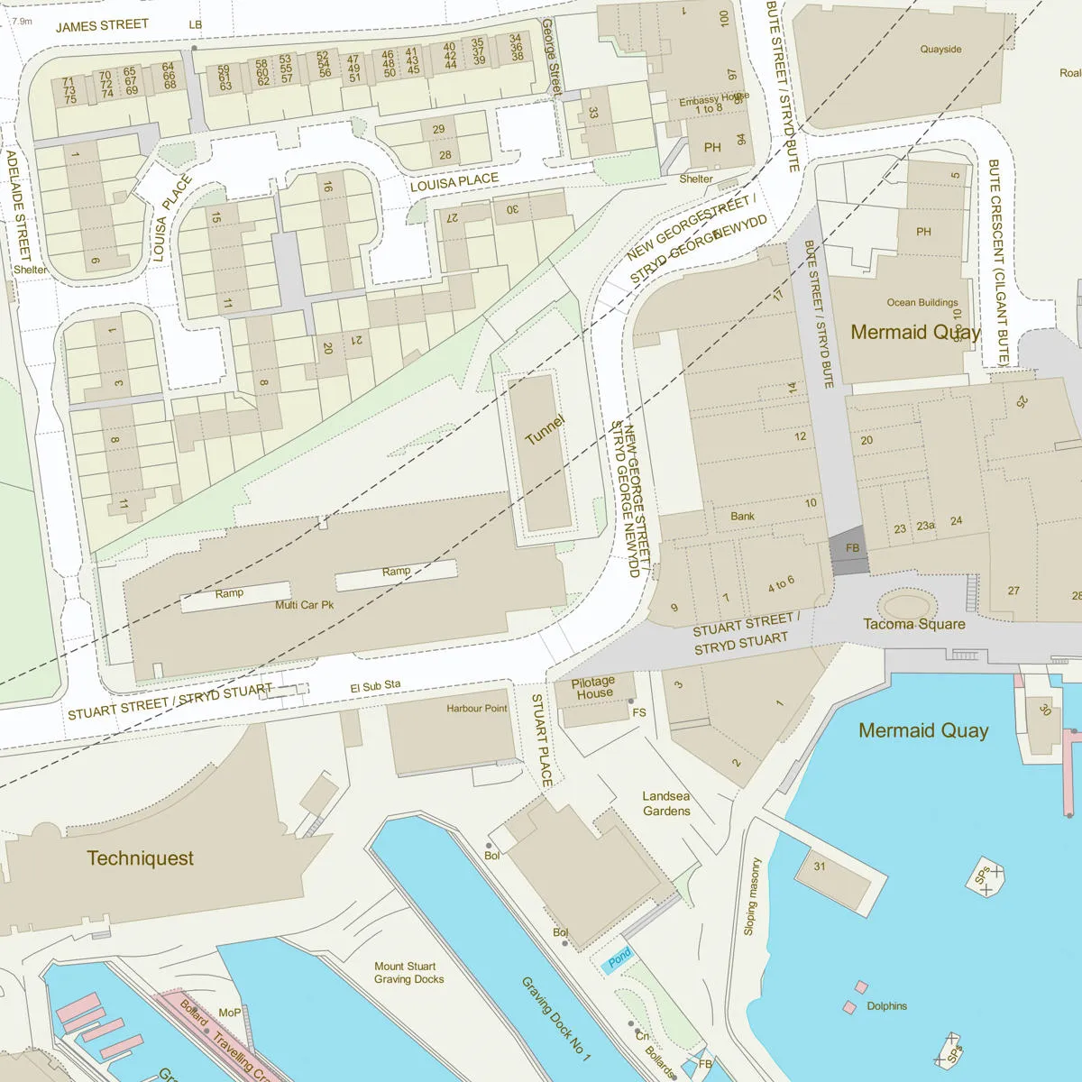
In a world where accurate geographical data is crucial, professionals in property development, environmental consulting, and other industries rely on Ordnance Survey’s MasterMap® for its unmatched precision and reliability. For these sectors, geographical information systems (GIS) play a critical role in informing decisions, predicting trends, and ensuring compliance with regulations. While free mapping tools and data sets are often readily available, professionals consistently turn to Ordnance Survey’s MasterMap® for its unmatched precision, reliability, and versatility.
In this post, we’ll explore why MasterMap® is the go-to mapping solution for industry professionals, and why it consistently outshines free alternatives. If you’re working in property development, environmental consulting, or any other profession that relies on accurate geospatial data, this blog is for you.
View and download OS MasterMap® of your area here

What is Ordnance Survey MasterMap®?
MasterMap® is Ordnance Survey’s flagship product, providing detailed and highly accurate mapping data for the UK. It is used by professionals in a wide range of industries for everything from site selection and planning applications to environmental impact assessments and land management. MasterMap® offers multiple layers of data, which include everything from building footprints and roads to water features and vegetation types, all designed to offer a comprehensive representation of the landscape.
The dataset is continuously updated to ensure accuracy and reliability, making it the preferred choice for professionals who require precise, up-to-date information for their work. But what exactly makes MasterMap® stand out when compared to free alternatives? Let’s delve into the reasons why professionals across sectors choose MasterMap® as their primary source of geographic data.
1. Unmatched Accuracy and Detail
When it comes to geographical data, accuracy is paramount. In industries such as property development, urban planning, and environmental consulting, the slightest inaccuracy can lead to costly mistakes, delays, and even legal issues. MasterMap® is known for its high level of precision, offering detailed mapping data at a scale that free alternatives simply cannot match.
MasterMap® is built using the most advanced surveying technology and fieldwork techniques, ensuring that the data is both accurate and reliable. With data capturing features down to individual building footprints, road networks, and land boundaries, it provides a level of granularity that is indispensable for professionals. In property development, for example, architects, surveyors, and urban planners rely on MasterMap® to accurately define property lines, access routes, and infrastructure, ensuring that designs are not only feasible but also compliant with zoning regulations.
Free alternatives, on the other hand, often lack this level of detail or rely on outdated or less precise methods of data collection. While they may be sufficient for basic needs, they are not suitable for projects that require a high degree of accuracy, such as land surveying or environmental assessments.
2. Comprehensive Coverage Across the UK
Ordnance Survey’s MasterMap® offers nationwide coverage, including detailed data for urban, suburban, and rural areas. Whether you’re working in the heart of London or on a development site in the Scottish Highlands, MasterMap® provides the same high level of detail, ensuring that no matter where your project is located, you’ll have access to accurate data.
In comparison, free alternatives often focus on specific regions or have limited geographical coverage. This can be a significant drawback for businesses or professionals working across multiple locations, as it forces them to rely on multiple sources of data, which can result in inconsistencies and gaps in the information.
MasterMap® ensures that you can work with a single, unified dataset, regardless of location. This nationwide coverage is crucial for property developers who manage multiple sites, as it ensures consistency and avoids the need to switch between different mapping systems or data sources.
3. Up-to-Date Information
Geographical data is constantly evolving. New buildings are constructed, roads are expanded, and natural features like rivers or forests change over time. MasterMap®’s data is continuously updated, providing professionals with access to the latest information available.
For industries like environmental consulting, keeping up with changes in the landscape is crucial for tasks such as environmental impact assessments, flood risk analysis, or conservation planning. MasterMap®’s regularly updated data ensures that these professionals are working with the most current and accurate representations of the land.
In contrast, many free alternatives rely on outdated data or lack regular updates. This can result in errors or missed opportunities—especially in fast-moving sectors like property development, where delays can have a significant financial impact.
4. Advanced Functionality and Flexibility
MasterMap® isn’t just about accurate data—it also offers advanced functionality that makes it incredibly versatile. The dataset is designed to integrate seamlessly with a wide range of Geographic Information Systems (GIS) and software tools. Whether you're using ArcGIS, QGIS, or other industry-standard platforms, MasterMap® can be easily incorporated into your workflows to support spatial analysis, site selection, and more.
Moreover, MasterMap® is available in various formats that cater to different needs. This flexibility is key for professionals who require tailored solutions. For example, in environmental consulting, a user may need to analyse topography, vegetation, and water features, all of which are represented in separate data layers within MasterMap®. With the right tools, these layers can be combined to offer deep insights that support decision-making.
Free mapping alternatives, while useful for basic mapping purposes, often lack the advanced tools and customisation options that MasterMap® provides. Professionals who need to perform complex spatial analysis or integrate multiple data sources will find free alternatives to be limiting in comparison.
5. Industry Recognition and Trust
MasterMap® is the industry standard for professional-grade geospatial data in the UK. It is widely recognised and trusted by professionals across a range of industries, including property development, environmental consulting, transportation, and more. Whether you're a land surveyor or a town planner, MasterMap® provides a trusted source of geographic information that is relied upon by government agencies, local councils and private sector businesses alike.
The credibility of Ordnance Survey as an institution also plays a big role in MasterMap®’s widespread adoption. As the national mapping agency for Great Britain, Ordnance Survey has built a reputation for producing high-quality, authoritative data, and this trust is reflected in the widespread use of MasterMap®.
By contrast, free alternatives may not carry the same level of recognition or trust. While they may be useful for informal or non-professional purposes, they do not have the same industry pedigree or endorsement as MasterMap®. For professionals who rely on precise, accurate data for legal, regulatory, and planning purposes, using a source like MasterMap® is a necessity.
6. Legal and Compliance Assurance
In many sectors, particularly in property development and environmental consulting, compliance with legal and regulatory requirements is non-negotiable. Using inaccurate or outdated data can lead to costly mistakes, fines, or delays. MasterMap® is not only trusted for its accuracy, but it also ensures that users are working with data that meets the required standards for compliance.
For example, property developers may need to submit planning applications or environmental assessments that rely on up-to-date mapping data. Using data from free sources may leave room for ambiguity or legal challenges. In contrast, MasterMap® offers the assurance that the data you’re using is both accurate and compliant with the relevant regulations.
7. Dedicated Support and Resources
Another key advantage of using MasterMap® is the support and resources available from Ordnance Survey. As a paid service, MasterMap® comes with access to dedicated customer support through MapServe®, user guides and technical assistance. Whether you’re facing technical issues or need help with integration, we offer professional support to ensure that you get the most out of the data.
Free alternatives, on the other hand, often lack dedicated support. If you run into issues with free datasets, you may be left on your own to figure things out. For professionals who need to rely on data to make
important decisions, having access to expert support is an invaluable resource.
In conclusion, while free mapping tools may seem like an attractive option, professionals in industries like property development, environmental consulting, and urban planning know that Ordnance Survey’s MasterMap® is the best choice for accurate, reliable, and up-to-date geographical data. The dataset’s unmatched detail, nationwide coverage, regular updates, and advanced functionality make it an indispensable tool for professionals who rely on precise data to make informed decisions.
By choosing MasterMap® over free alternatives, you’re investing in a solution that ensures your work is both accurate and compliant, while also benefiting from the credibility of Ordnance Survey. For professionals looking to stay ahead of the curve, MasterMap® is the gold standard in geospatial data, trusted by industry leaders across the UK.
