In today's fast-paced world, where technology continues to evolve at an unprecedented rate, few innovations have had as profound an impact on our daily lives as digital maps. From guiding us on our daily commutes to helping us explore new destinations, these virtual cartographic marvels have become an indispensable part of modern life. However, their influence extends far beyond just navigation; they're revolutionising the way we design, construct, and manage the built environment. With the integration of 3D mapping technologies, coupled with the fact that we hold the map of the world in the palm of our hand, stakeholders can now visualise spatial relationships with unprecedented clarity, enabling more precise and efficient planning and execution of construction project.
Download OS Digital Maps here

Enhancing Design and Planning
The building industry has been quick to embrace digital mapping technology as a powerful tool for enhancing design and planning processes. Architects and urban planners, in particular, have benefited from the ability to access detailed spatial data and perform comprehensive site analysis using digital maps. For example, tools like Google Earth and GIS software allow designers to assess factors such as topography, land use, and infrastructure with unprecedented detail and accuracy, enabling more informed decision-making and better design outcomes.
In addition to site analysis, digital mapping technology is also revolutionising the way architects and designers conceptualise and communicate their ideas. Building Information Modelling (BIM), a process that involves creating digital representations of physical buildings, often integrates mapping technology to provide a holistic view of the built environment. This allows designers to visualise proposed developments in the context of their surroundings, identify potential conflicts or constraints, and communicate their vision more effectively to stakeholders.
The Evolution of Digital Mapping Technology
The journey of digital mapping technology has been a remarkable one, marked by significant advancements in both hardware and software. Historically, cartography was a laborious process involving the manual creation of paper maps, often requiring intricate surveying techniques and painstaking attention to detail. However, the advent of computers and Geographic Information Systems (GIS) in the latter half of the 20th century transformed the landscape of cartography, paving the way for the development of digital mapping technology.
One of the earliest examples of digital mapping technology is the Geographic Information System (GIS), which emerged in the 1960s and 1970s. GIS-enabled users to store, analyse, and visualise spatial data in digital form, laying the foundation for the modern digital mapping tools we use today. The introduction of satellite imagery and Global Positioning System (GPS) technology further accelerated the evolution of digital maps, providing unprecedented access to real-time, high-resolution geographic data. Such an example is the National Underground Asset Register (NUAR) by the government which documents all underground pipes and cables.
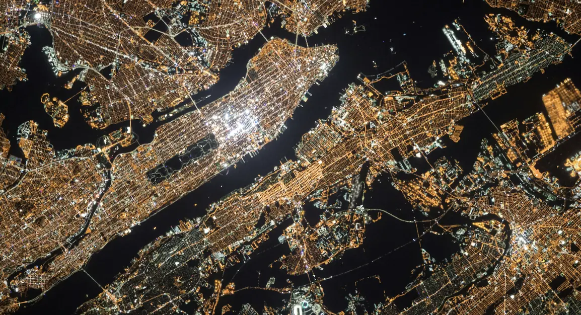
Google Earth Image
Project Management and Logistics
In construction, digital mapping technology is streamlining project management and logistics processes, leading to greater efficiency and cost savings. By integrating mapping technology into BIM workflows, construction teams can visualise project progress in real-time, identify potential conflicts or delays, and streamline communication between stakeholders. For example, drones equipped with GPS and imaging technology can be used to survey construction sites and monitor progress, providing valuable data to project managers and enabling them to make informed decisions on the fly.
Furthermore, digital maps are also playing a crucial role in logistics planning and optimisation. By analysing factors such as traffic patterns, road conditions, and weather forecasts, construction companies can develop more efficient transportation routes and schedules, reducing fuel consumption, minimising delays, and improving overall project delivery times. This not only saves time and money but also reduces the environmental impact of construction activities, contributing to a more sustainable built environment.
Enhancing User Experiences and Community Engagement
Beyond design and construction, digital mapping technology is enhancing the way we interact with buildings and spaces, ultimately improving user experiences and fostering community engagement. Indoor navigation systems, for example, use digital maps to guide visitors through complex structures such as airports, shopping malls, and hospitals, providing turn-by-turn directions and points of interest along the way. This not only improves convenience for users but also enhances safety and security by helping people navigate unfamiliar environments more easily.
Moreover, digital maps are empowering communities to actively participate in the planning and development of their neighbourhoods. Through crowd-sourced mapping initiatives and participatory GIS projects, residents can contribute local knowledge and feedback, helping to shape the future of their communities in meaningful and inclusive ways. For example, platforms like OpenStreetMap allow users to collaboratively map their neighbourhoods, documenting everything from infrastructure and amenities to cultural landmarks and historical sites.
The Future of Digital Mapping in the Building Industry
As we look to the future, the potential of digital mapping technology to transform the building industry is virtually limitless. From advances in artificial intelligence and machine learning to the proliferation of Internet of Things (IoT) devices and sensors, the tools and techniques available to designers, builders, and planners will continue to evolve, enabling new possibilities for innovation and sustainability.
For example, emerging technologies such as augmented reality (AR) and virtual reality (VR) have the potential to revolutionise the way we design, visualise, and experience the built environment. By overlaying digital information onto physical spaces, AR applications can provide users with immersive, interactive experiences that enhance their understanding of the built environment and facilitate more informed decision-making.
Furthermore, the increasing availability of real-time, high-resolution satellite images and LiDAR data creates new potential for sophisticated analytics and predictive modelling in the building industry. Understanding the power of big data and geospatial analysis allows designers and planners to obtain deeper insights into urban dynamics, environmental consequences, and infrastructure weaknesses, resulting in more resilient and sustainable built environments. Furthermore, the incorporation of 3D mapping technologies improves visualisation capabilities, allowing stakeholders to better grasp spatial relationships and plan building projects more precisely and efficiently.
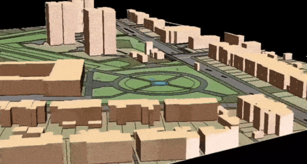
MapServe®'s 3D MasterMap sample
In conclusion, the evolution of digital mapping technology is reshaping the building industry in profound ways, from enhancing design and construction processes to improving user experiences and fostering community engagement. As we continue to navigate the future of our built environment, digital mapping technology will undoubtedly play a central role in shaping a more connected, sustainable, and inclusive world for generations to come.