If you are developing a site that generates any number of vehicle movements, one question is key: can vehicles move through your site easily and safely? It’s not just about ticking boxes for planning approval, it’s also about making sure your design works in real life conditions.
That’s where ‘swept path analysis’ comes in. It’s a way to check if your layout can handle the vehicles it’s designed for, helping you spot potential problems early and avoid expensive fixes or redesigns.
Get in touch to order your swept path analysis
Swept Path Analysis
What Is Swept Path Analysis?
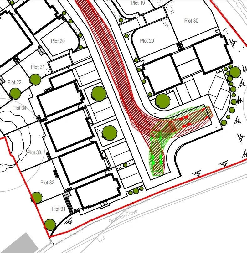
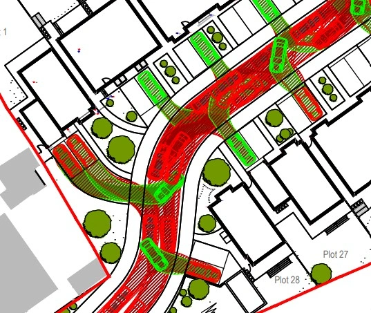
A good comparison is running toy cars along a playmat; except in this case, the playmat is your development layout, and the cars represent real vehicles like cars, refuse vehicles, and emergency vehicles. The point is to make sure the layout of your site actually works, allowing vehicles to move around safely and making sure that your road layout can handle the required traffic.
It’s an essential step to avoid unexpected issues, like a refuse vehicle struggling to access the site because of too tight a corner. This is often needed to show highways officers at your local planning authority that your design is ready for approval. Swept path analysis lets you:
- Make sure your site works for the vehicles it’s designed for.
- Spot potential issues early, before critical points in planning.
- Show clear evidence to planning authorities that your design is practical and safe.
Parking
How Swept Paths are Made
The analysis is done using specialist tools like AutoCAD with vehicle tracking plugins. This allows us to simulate how different vehicles move through the site, including turns, reversing and parking manoeuvres.
- The first step is using high-quality base mapping, such as OS MasterMap®, to provide an accurate representation of your site.
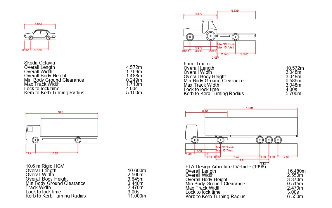
- Next, we model specific vehicles, such as refuse vehicles, HGVs, or fire engines, within the AutoCAD environment. These vehicle profiles are based on real-world dimensions, and scaled to fit accurately with the rest of your mapping.
- Using vehicle tracking software, we simulate how these vehicles navigate the site, accounting for turning radii, swept paths, and clearances.
Swept Path Profiles
Swept Path Expertise
While the software makes it possible to perform the simulations, the real value comes from the expertise behind the process. It’s about knowing which vehicles to model, understanding planning requirements, and interpreting the results. That is why we partner with expert providers to give you this service.
Let’s Get Started
At MapServe, we provide the mapping solutions you need to make swept path analysis. We specialise in the supply of OS mapping data to allow you to create a high-quality site layout.
But we don’t stop there. For the analysis itself, MapServe® collaborates with Geospatial Design, experts in delivering bespoke mapping and design solutions to your project. Jamie at Geospatial Design brings years of hands-on experience to give practical, visually clear results that help you make confident decisions.
To arrange a consultation, commission a project, or simply learn more, contact Jamie at [email protected].


