As a digital mapping firm based in the United Kingdom, MapServe® recognises the value of precise and up-to-date information for planning and development projects. We recently acquired NGD data from the Ordnance Survey, which includes useful information about building age. In this blog article, we'll look at how this new MasterMap® layer can be used to calculate building ages for approved development rights. We'll also share additional ideas and insights to help you navigate the process more efficiently.
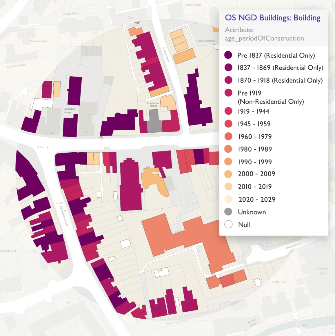
Building Age NGD layer, provided by the OS
Understanding Permitted Development Rights (PDR)
Permitted Development Rights allow some types of building work and land use modifications to be carried out without the need for planning permission. To qualify for PDR, you must meet certain criteria and constraints. One important consideration is the age of the structure, as older properties may have different regulations and restrictions than younger ones.
Using NGD Information for Building Age
Ordnance Survey's NGD dataset provides precise insights into the age of structures across the UK. Using this data layer, you may rapidly and precisely establish the age of a property, which is critical for determining eligibility for approved development rights. Simply overlaying the NGD layer on your existing mapping programme or platform will provide you easy access to this essential information.
Other NGD information includes detailed building footprints, land use classifications, elevation data, road networks, transportation infrastructure, green spaces, address and property information, points of interest, administrative boundaries, and utilities infrastructure. This comprehensive dataset is indispensable for urban planning, environmental management, property assessment, emergency response planning, tourism, and various other applications requiring detailed spatial information.

Cotswold houses / style emerged in the 16th century
Tips for Using NGD Information
Use Historical Mapping: NGD information frequently contains historical mapping data, which allows you to follow changes to a property over time. Analysing historical maps and aerial photos can provide useful insights into the growth of a building and its surroundings.
Cross-Reference with Local Records: While NGD data provides a thorough picture of building age, it is always a good idea to check it against local records and archives. Local planning offices and historical groups may have extra information or evidence to help verify the age of a property.
Consider Architectural elements: In addition to using NGD data, consider evaluating a building's architectural elements to establish its age. Building materials, construction procedures, and architectural styles can all help determine when a home was built.
Seek Professional Help: If you're having trouble identifying the age of a building, try hiring a surveyor or a historical building specialist. Their skills and knowledge can help ensure that your assessments are accurate and reliable.
Why it Is Important to Know a Building's Age
Understanding a building's age is important for a variety of reasons, including its architectural significance. Each era of architectural history has its own set of styles, techniques, and features that represent the time's cultural, social, and technological advances. Victorian-era buildings, for example, frequently include grandiose facades, exquisite brickwork, and rich details that represent the period's opulence and skill. Similarly, buildings from the Modernist movement emphasise simplicity, functionality, and geometric forms, indicating a shift towards industrialisation and mass production.
Architects, historians, and preservationists can learn about the progression of architectural styles and trends by identifying the age of a structure, which helps to document and preserve our constructed heritage. Furthermore, knowing a building's age can help guide restoration projects, adaptive reuse initiatives and heritage conservation activities, ensuring that these unique cultural treasures are conserved for future generations to appreciate and enjoy.

Liberty, London / built 1924
Navigating the Permitted Development Process
Once you've determined a building's age using NGD data and other sources, you can confidently evaluate its eligibility for approved development rights. To ensure compliance with legislation, thoroughly analyse the precise requirements and constraints set forth by local planning authorities.
Incorporating NGD data from the Ordnance Survey into your planning and development projects will greatly improve your capacity to assess building age for approved development rights. By combining this essential data layer with other suggestions and insights, you may confidently and efficiently traverse the process.