The Power of Ordnance Survey's MasterMap®
Ordnance Survey MasterMap® is well-known in the cartography and Geographic Information Systems (GIS) communities for its precise mapping of the UK. MasterMap® was introduced in 2001 and it has changed how we understand and use spatial data. It provides detailed coverage of the UK's varied landscapes and urban areas.
This blog post will delve into the complexities of Ordnance Survey MasterMap®, offering light on its origins, practical applications, and relevance in molding our understanding of the UK's geography. We'll look at the beginnings of MasterMap®, including the technology and procedures used to reach its great degree of information. We will also explore how MasterMap® is used in various sectors such as urban planning, infrastructure development, environmental management, and emergency services. Its connection with GIS platforms has made it easier to conduct spatial studies and make educated decisions.
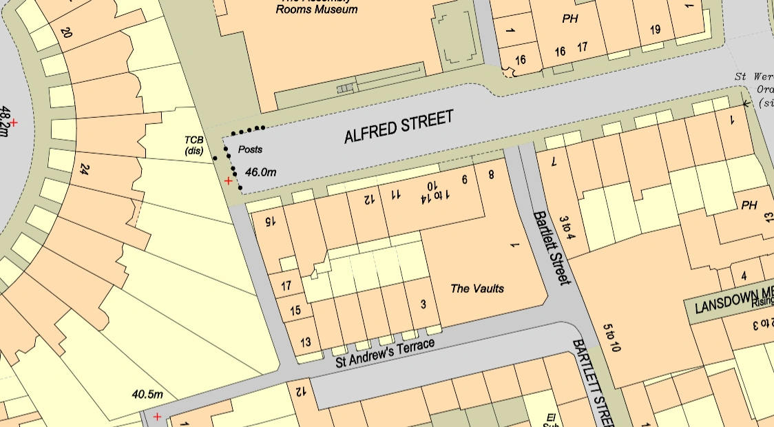
MasterMap® sample
Understanding Ordnance Survey MasterMap®
OS MasterMap® is a meticulously curated digital mapping database created by the Ordnance Survey, the prestigious national mapping organization of the United Kingdom. This database is precisely structured to provide a thorough depiction of both the built and natural environments, including a wide range of spatial attributes.
These features include roads, buildings, land use classifications, topographical contours, bodies of water, and administrative boundaries, among others. MasterMap® uses a combination of cutting-edge technologies such as aerial imagery, ground surveys, and advanced geospatial techniques to provide a detailed and regularly updated map of the UK's landscape at various scales, from the national level down to intricate street-level details.
This dataset is a fundamental resource for a wide range of applications in a variety of industries, supporting decision-making processes and fostering innovation in areas such as urban planning, infrastructure development, environmental management, and emergency response.
The Creation Process
The development of MasterMap® is evidence of cooperative endeavors that combine sophisticated surveying methods, state-of-the-art remote sensing technologies, and painstaking data processing procedures. Using a fleet of planes outfitted with cutting-edge aerial sensors to collect high-resolution imagery and LiDAR (Light Detection and Ranging) data—which is necessary for detailed mapping—is the fundamental component of Ordnance Survey's strategy.
The OS subjectS these files to rigorous processing to extract elevation data and detailed topographical properties, which helps us create an extensive geographical database. Additionally, ground surveys are essential to improving the dataset's accuracy.
Skilled surveyors ensure the integrity of data relating to roads, buildings, and land use patterns by conducting on-the-ground verification and updates of spatial information using cutting-edge GNSS (Global Navigation Satellite System) technology. They produced a digital mapping dataset with high precision and seamless integration of many spatial data layers through their joint efforts, providing a solid basis for a wide range of applications in different industries.
Applications and Significance
MasterMap® is a versatile tool with applications in a variety of industries. Its application spans urban planning and infrastructure development, as well as environmental management and emergency response.
Urban planners use MasterMap® to analyse land use trends, design transportation networks, and develop strategies for long-term urban growth. Architects and engineers benefit from its detailed building footprints and elevation data, which help with infrastructure design and flood risk assessment. Environmental experts use MasterMap® to investigate habitat distribution, monitor land cover changes, and protect biodiversity hotspots.
In times of crisis, emergency responders rely on MasterMap® for situational awareness, which allows for more efficient disaster response and post-event recovery activities. This varied implementation of MasterMap® emphasises its value as a foundational resource across a wide range of fields.
Future Directions and Innovations
As technology advances, Ordnance Survey remains committed to improving and widening MasterMap®'s capabilities in order to better meet the changing needs of its customers. Future generations of MasterMap® will incorporate cutting-edge advances in artificial intelligence, machine learning, and geographical analysis. These innovations will simplify data processing operations, improve data accuracy, and enable real-time updates, ensuring that consumers have access to the most recent information accessible. Furthermore, Ordnance Survey is currently investigating the integration of emerging technologies such as 3D modelling, augmented reality, and virtual reality into MasterMap®.
The creators intend for these novel elements to provide users with immersive and interactive visualisation experiences, enabling them to better understand and study spatial data. Ordnance Survey is increasing the utility and versatility of MasterMap® by constantly adopting technology innovations, enabling users in a variety of industries to make informed decisions and drive innovation.
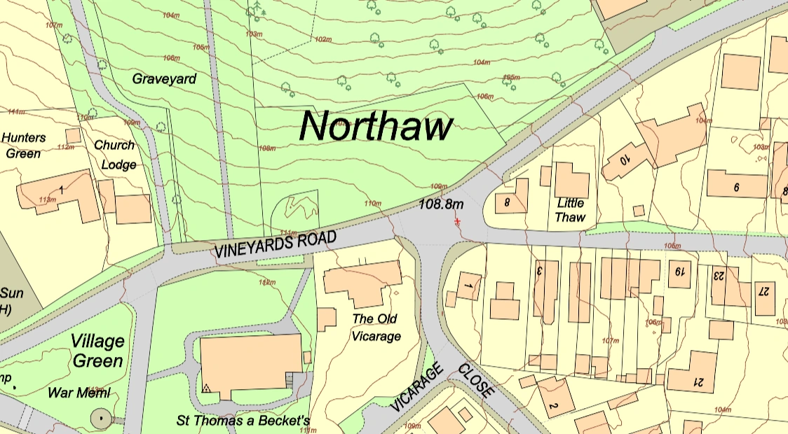
MasterMap® with 1m contours
MasterMap® is a symbol of modern cartography, exemplifying the precision, and innovation that characterise contemporary mapping processes. Its extensive coverage, thorough depiction, and unparalleled precision have transformed how we perceive, analyse, and use spatial data across the United Kingdom. From urban planning projects to environmental conservation efforts, MasterMap® is critical to aiding informed decision-making processes across a wide range of sectors.
MasterMap®'s sophisticated mapping capabilities offer essential insights into the intricate spatial relationships that characterise the UK's topography. By precisely showing characteristics like as highways, buildings, land use patterns, and terrain contours, it serves as a basic resource for understanding the country's geography in unprecedented depth.
Ordnance Survey's constant dedication to excellence and continuous innovation ensures that MasterMap® remains at the forefront of detailed mapping activities. Continuous advances in technology and data processing techniques improve the dataset's accuracy, usefulness, and accessibility. Furthermore, Ordnance Survey continually solicits feedback from users and stakeholders to identify areas for development and extension, ensuring that MasterMap® adapts to the changing needs of its broad user base.
As we traverse the intricacies of today's world, MasterMap® is a reliable companion, enabling users to make confident and clear judgements. Its ongoing relevance and significance highlight its critical role in developing our understanding of the UK's geography and promoting sustainable development methods for future generations.