Download our professional mapping here
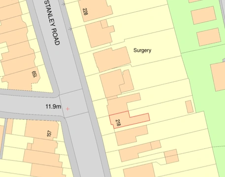
1. Planning permission
A planning application usually needs a location plan which shows the proposal in its surrounding context and a site plan (or block plan) which shows the development in more detail and display any roads and buildings on land adjoining the application site.
2. Finding potential development plots
This is used by property developers typically to find ‘off market’ plots. Using maps is a huge help for any developer looking for plots. You are able to identify gaps in the street scene, small bungalows on large bits of land, and potential backland plots, all of which are ready for redevelopment.

3. Sales particulars used by estate agents
Maps used by estate agents should be a powerful visual statement and also highlight the area that covers using accurate and up-to-date mapping. It is also important to have all the information about a property’s location, including neighbourhood demographics, cultural hotspots, transport links, schools, local shops as well as points of interest.

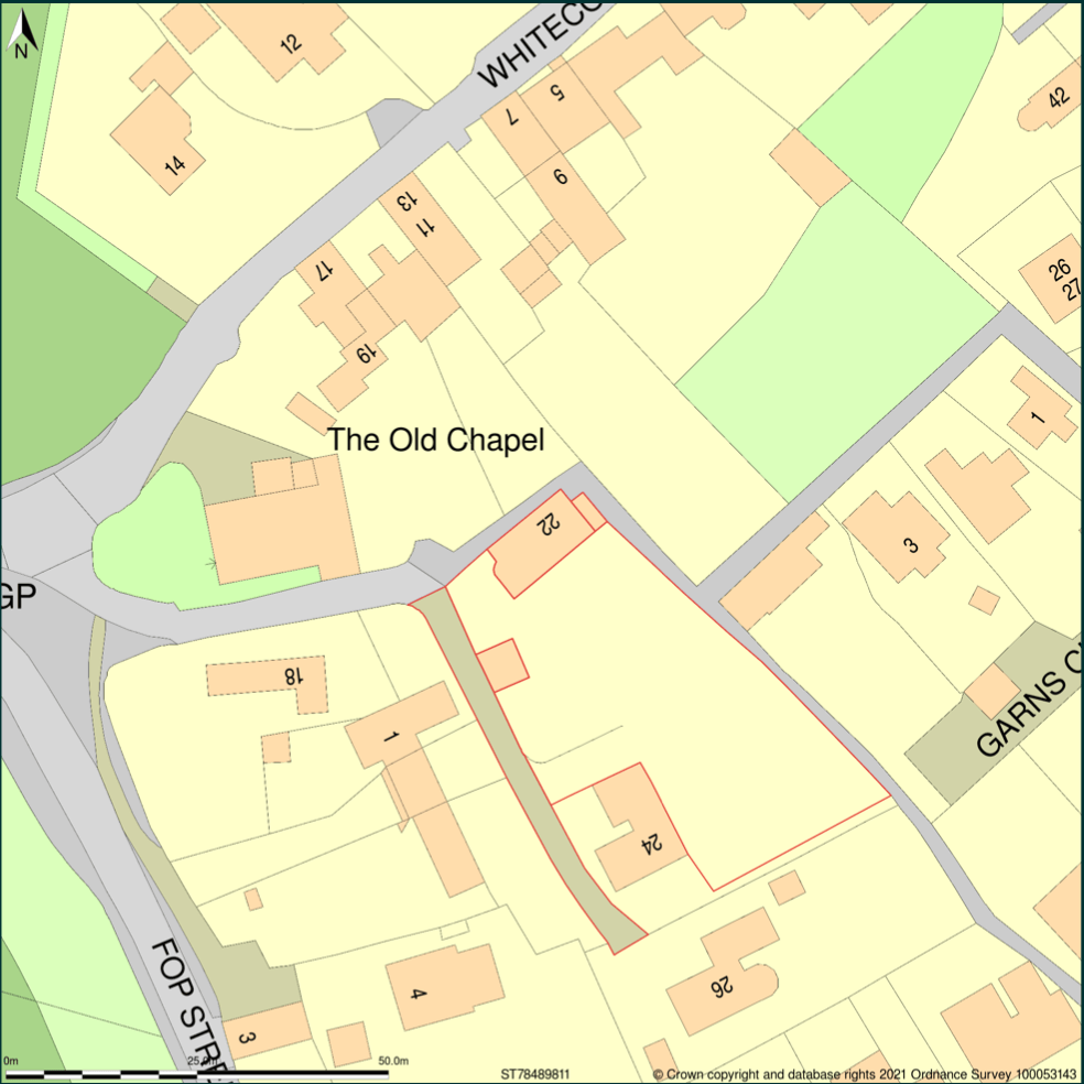
4. Land registry plans
For example when registering the ownership of a piece of land. Records the general position of the boundaries of a registered title. They are usually 1:1250 in urban areas and 1:2500 in rural areas.
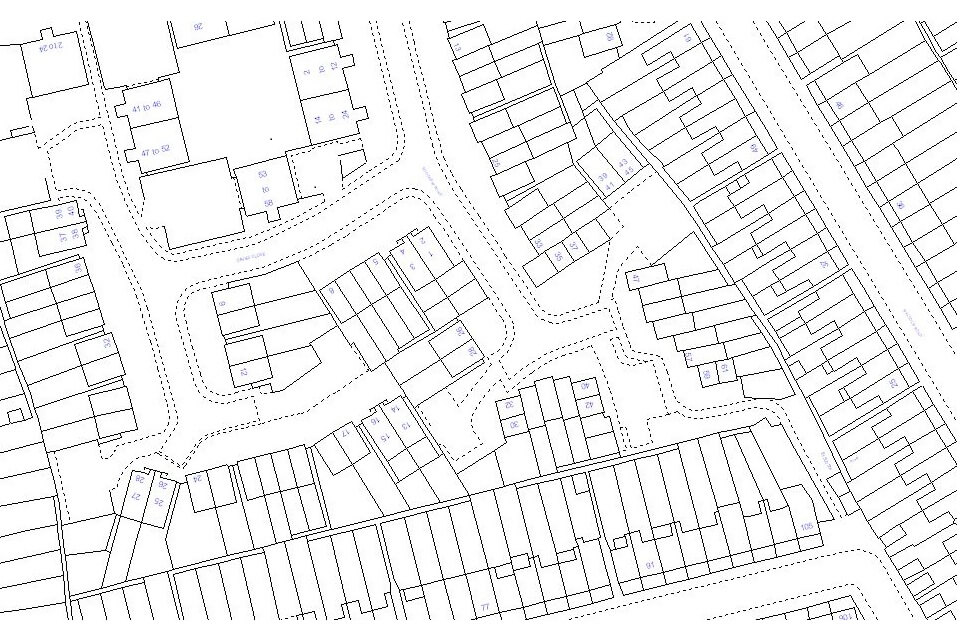
Image provided by www.gov.uk
5. Viewshed analysis
When combined with height data you can see how a building is visible from the surrounding area.
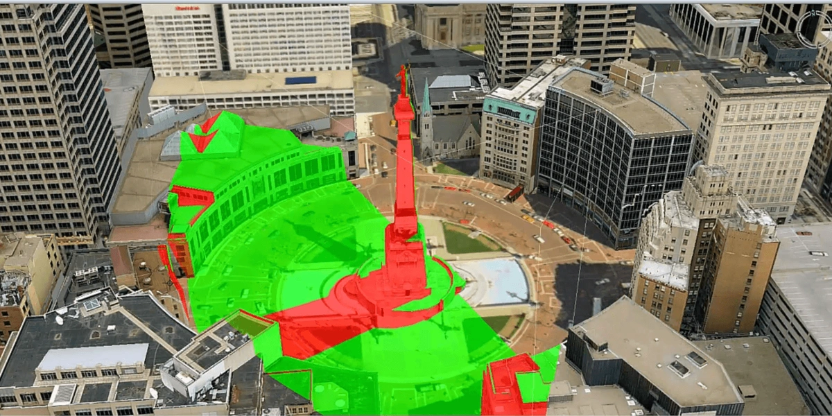
Image provided by https://blog.hexagongeospatial.com/
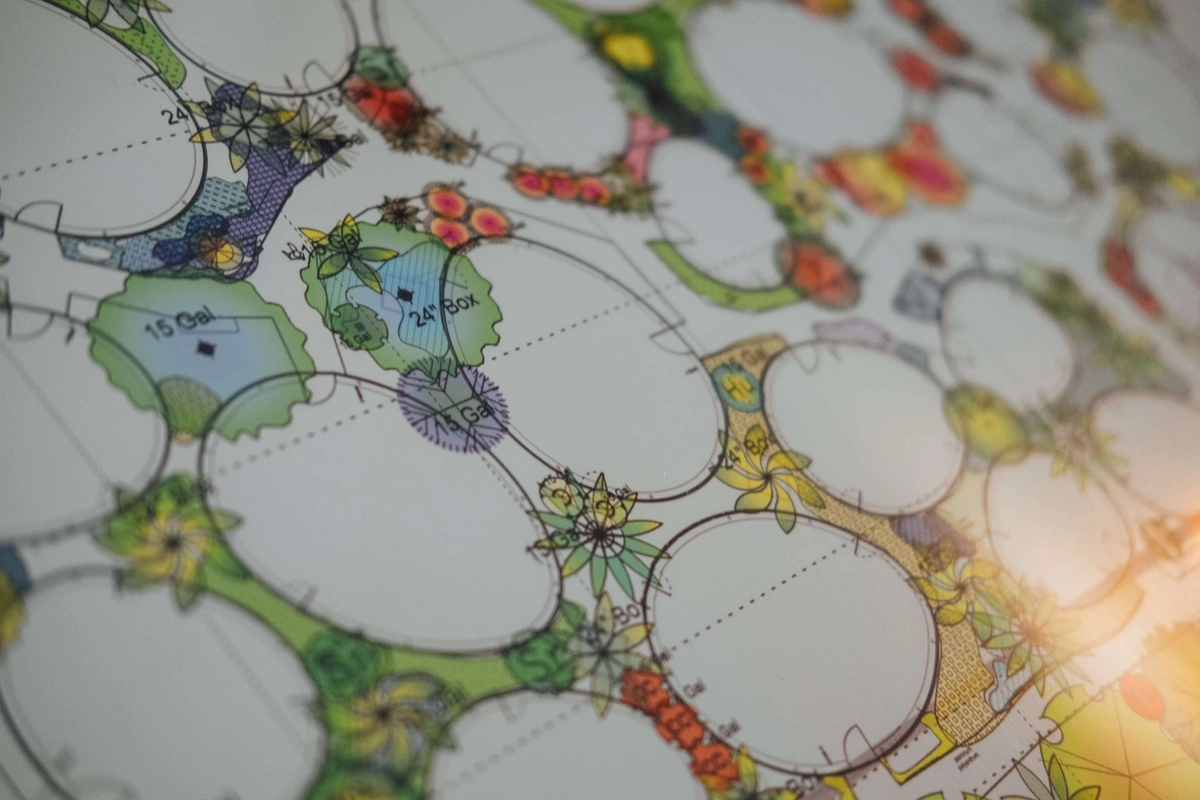
6. Area analysis
Evaluation of an initial direction of the design – adjacent properties, access roads, commercial developments nearby, vegetation and water bodies nearby, cultural magnets. We offer a new Site Analysis map that can be used a base map to your site analysis. You can download a sample here.

Image provided by Archisoup
7. Site appraisal – feasibility of the site
At the early stages of a project appraisals of potential sites for development may be carried out by a surveyor, before the appointment of a consultant team, while trying to justify the business. Appraisal of alternative sites may also be an important part of an environmental impact assessment. Subsequent site appraisals by the consultant team will obtain more data and details that might not have been available on site. The client can also provide further information. They are an opportunity for the consultant group to familiarise themselves with the location site and assess the detailed surveys that might be necessary. All the data gathered are then displayed on a detailed map.
8. Plan delivery routes for construction materials
The transport of construction materials represents up to 30% of freight movements in cities. The size and volume of these materials often present significant disturbances to the daily life of citizens so the routes are carefully planned using detailed maps.

9. Prepare a project’s manual
A collection of documents related to the construction work on a project, typically including bidding requirements, sample documents, conditions of the contract, and specifications.

10. Creation of plat/survey map.
Also referred to as a Property Map. can be very detailed and should contain a great detail of information about the subject property including ownership, rights and limitations to using the property. A plat map, also known as a "plat," shows you how a piece of land is divided into lots in your county. It must be drawn to scale and records the size of the land, its boundary locations, nearby streets, flood areas, and any easements or rights of way. The Plat Map is typically filed along with the deed to the property or other public records regarding the property in the county recorder’s office.
Image provided by Realtor.com
11. Identify a project’s requirements
Before starting the design process a lot of factors have to be considered, such as the location of the land, the landform, the weather, even the country and city in which the future project will be situated in. Mapping is essential in identifying all of the above concerns.
12. Helps design the project in consideration of its surroundings
Mapping can help to identify and analyse what a project needs while taking into consideration its surroundings and nature. For example, a project situated near the sea has completely different requirements than a project situated at the top of a hill or mountain. Nature consideration and respect are crucial in the building profession even more now than before.

13. Use it as a base map to analyse further an aspect or aspects of a site/area (traffic/sound/light maps) – creative/generative process.
Cartography can be considered both an art and a science. It combines design, geography and geographic information data. Maps serve a wide variety of purposes; they may be descriptive and show a specific location like a street map, exploratory like a thematic map that shows the distribution of phenomena and their properties, explanatory which can describe a specific subject to an audience, or even rhetorical which is a map that tries to convince a crowd about a specific subject.