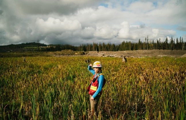
The value of accurate and thorough geographical information in environmental science cannot be overstated. Environmental scientists research the Earth's ecosystems, climatic trends, and the environmental impact of human activities. These specialists frequently rely on Computer-Aided Design (CAD) maps to carry out their task efficiently. These CAD maps have transformed the way environmental scientists conduct research, allowing them to make more informed decisions and improve their working conditions. In this post, we will look at how environmental scientists use CAD maps, why these maps are useful in their work, and how they improve their entire working experience.

View and download your CAD plans here
What exactly are CAD maps?
Before entering into their use in environmental research, let us first define CAD maps. CAD, an abbreviation for Computer-Aided Design, is a technology for creating detailed and exact two-dimensional (2D) and three-dimensional (3D) drawings and models. CAD maps, in particular, are maps created with CAD software that have detailed designs and precise spatial data.
CAD maps are made by combining data from many sources, such as geographic information system (GIS) data, satellite photography, and field surveys. Environmental experts manipulate and analyse these maps using CAD software, which improves their abilities to research and safeguard our natural world.

Environmental Science CAD Map Applications
1. Site Evaluation and Planning
Environmental scientists examine and design environmental projects using CAD maps. CAD maps provide a visual depiction of the environment's existing status and the potential repercussions of planned changes, whether it's researching the viability of a new conservation area, planning land use, or evaluating the impact of infrastructure projects. Scientists can then make educated decisions that prioritise conservation and sustainability.
2. Habitat Mapping
Understanding the distribution of plants and fauna in varied environments requires habitat mapping. CAD maps can show precise information about ecosystems, their boundaries, and the animals that live within them. These maps are used by environmental scientists to identify priority ecosystems for conservation and to track changes over time caused by causes such as climate change or human encroachment.
3. Disaster Planning
CAD maps are essential for assessing and preparing for natural disasters. They can be used to simulate flood zones, earthquake danger, and wildfire risk. These maps are used by environmental scientists to create emergency response plans, evacuation routes, and measures to reduce the impact of disasters on both the environment and communities.
4. EIAs (Environmental Impact Assessments)
Before beginning any development project, an EIA is carried out to assess its potential environmental effects. Environmental scientists can use CAD maps to visualise and analyse suggested modifications, allowing for a complete assessment of the impact on ecosystems, water bodies, and air quality. This guarantees that construction projects follow environmental standards and guidelines.
Why Are CAD Maps Beneficial to Environmental Scientists?
Precision
The quality and accuracy of CAD maps is one of their most significant advantages. Environmental scientists can use CAD software to build highly detailed and scaled maps, making it easier to detect tiny changes in the environment. When working with data that influences governmental decisions and conservation initiatives, this precision is critical.
Data Integration
CAD maps allow for the integration of a variety of data sources, including aerial images, topography data, climate data, and GPS information. This integration enables environmental scientists to construct multi-layered maps that provide a comprehensive view of the environment, which is critical for their research and decision-making processes.
Visualisation
Because humans are inherently visual creatures, CAD maps give a concrete means to visualise complex environmental data. These maps can help environmental scientists communicate the significance of their study to non-technical audiences such as policymakers, communities, and conservation organisations.
Collaboration
Environmental scientists and other stakeholders may readily exchange and amend CAD maps, facilitating collaboration. CAD maps serve as a shared platform for sharing and amending information, whether it's a team of researchers working on a project or engaging with government agencies and NGOs.
How Can CAD Maps Improve the Work Experience of Environmental Scientists?
The use of CAD maps in environmental science has substantially improved researchers' work experience. These maps improve efficiency by lowering the time and effort required to create precise spatial representations. This time savings enables environmental scientists to devote more time to data analysis, fieldwork, and problem resolution. Furthermore, CAD maps aid in the organisation and centralization of data, reducing the danger of data loss or disorganisation. They also aid in risk assessment by giving clear visual representations of environmental dangers, making it easier to analyse and implement risk-mitigation measures. Aside from research, CAD maps play an important role in advocacy, aiding in the communication of complicated environmental concerns to policymakers and the general public, and pushing policies that prioritise environmental well-being. In summary, CAD maps not only improve work productivity but also promote the adoption of sustainable practises in the field of environmental science.
The use of CAD maps into environmental science has altered how researchers study, manage, and protect the environment. These maps provide environmental scientists with precision, data integration, visualisation, and collaboration, all of which improve their job experience. Because of the efficiency gained by using CAD maps, scientists may devote more time to study and campaigning, ultimately leading to a more sustainable and ecologically conscious world. Environmental scientists will rely on CAD maps as technology advances to handle rising environmental concerns and protect our world for future generations.