We've just launched a groundbreaking 'Pro' version of OS MasterMap®® in CAD (DWG and DXF) format. This is in addition to the existing 'Standard' version of MasterMap®. This will feature:
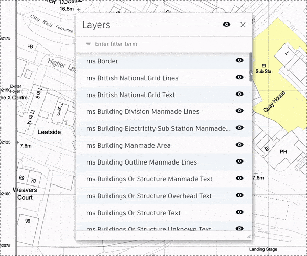
- Up to 67 individual layers of geographical information, compared with up to 13 key layers in our current black & white version and 20 for the colour version, where certain layers are merged for ease of use. This will allow far more granular styling and control of layers.
- A 'Group Layer Filter' to allow layers of similar types to be grouped together, for example all of the 'railway' related layers. This allows for faster management of large numbers of layers.
- Prefixed layer names using 'ms_' (for MapServe®) to allow easy filtering when there may be many layers in your CAD software from other sources.
- All available layers, some of which are not available in the current version such as borders (national and regional).
- A black and white or colour filled option.
OS MasterMap® is available for the UK here
| Comparison | MasterMap® 'Pro' | MasterMap® 'Standard' |
|---|---|---|
| Description | All layers separated for complete granular design control | Just the key layers, with some combined for ease of use |
| Number of Layers | Up to 67 (all available layers) | Up to 20 (key layers) |
| Prefixed Layer Names | Yes ('ms_') | No |
| Group Layer Filter | Yes | No |
| Black & White Option | Yes | Yes |
| Colour Options | Yes | Yes |
| Layer Description | All | Key layers |
Interested? Download samples here.
Written by Tom Dawson