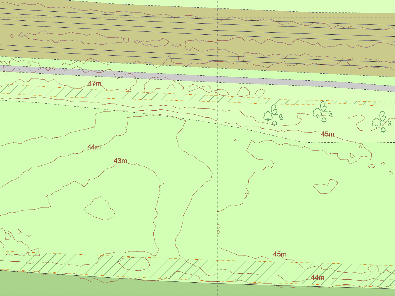
1m Contours Launched on MapServe®
We're pleased to launch 1m contours as an optional CAD layer to OS MasterMap®. Available in DWG and DXF formats, the contours are an accurate representation of the topography of the land and cover over 60% of England, Wales and a section of Scotland. A contour line is a brown map line that represents an imaginary line on the ground surface, all of whose points are at the same height above a datum plane, which commonly means sea level.
The dataset is derived from a Light Detection and Ranging (LIDAR) survey undertaken by the Environment Agency. This is an airborne mapping technique, which uses a laser to measure the distance between the aircraft and the ground. Up to 500,000 measurements per second are made of the ground, allowing highly detailed terrain models to be generated at spatial resolutions of between 25cm and 2 metres.
The 1m contours are referenced to Ordnance Survey Newlyn, using the OSTN’15 transformation. The LIDAR data has a vertical accuracy of +/-15cm RMSE.
Our contours are displayed as two additional layers on OS MasterMap® DWG/DXF as follows:
- ms Contour Heights (m) Text
- ms Contour Lines
Download 1m contours for your plans here
Contour lines are essential for comprehending the elevation profile of a terrain or a specific land formation. This knowledge might be useful while planning a hike or can be proven lifesaving in an emergency survival situation. Aside from backpacking and hiking, they are used by a variety of different professionals, including land surveyors, architects, arboriculturists, foresters, engineers, miners, geologists, and hunters.
A contour line is formed between different points of the same height, therefore any single contour line will have the same height all along its length. The height difference between different contour lines is generally 5 metres, however in particularly steep or mountainous places with thick lines at 50-metre intervals, it will be 10 metres. The contour interval used is shown by the map key. Here at MapServe® we offer 1m contour lines which are more suitable for design professionals.
Understanding 1m Contours and Their Significance
The introduction of 1m contours represents a significant advancement in topographical mapping. These contour lines, derived from high-resolution LIDAR data, provide an incredibly detailed view of the terrain. This precision is invaluable for professionals such as surveyors, architects, and engineers, enabling them to make more accurate assessments and decisions regarding land use and development.
Applications and Benefits
1m contours are particularly useful in areas requiring detailed topographical information. For instance, in urban planning, these contours help in designing infrastructure that aligns with the natural landscape, reducing the risk of environmental impact. In forestry and agriculture, they aid in understanding land gradients and planning for effective land management.
Future Enhancements
As technology advances, the integration of 1m contours with other geographic data sets will continue to enhance the accuracy and usability of maps. This integration supports the development of smart cities and the implementation of innovative solutions in environmental conservation and urban planning.
For more information on 1m contours or to order go to MapServe®.
You can also check our Contour Maps guide.